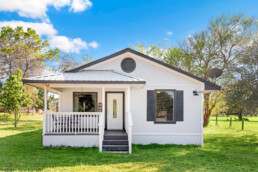
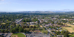
Marin County ADU Requirements
If you're considering adding an Accessory Dwelling Unit (ADU) to your property in Marin County, California, it's essential to understand the local requirements to ensure a smooth and compliant building process. ADUs offer a fantastic opportunity to expand living space, generate rental income, or provide housing for family members. However, navigating the specific regulations in Marin County is crucial.
Types of ADUs in Marin County
Marin County recognizes several types of ADUs:
- Attached ADUs: These units are connected to the main residence and can be located at the back, side, or front of the house.
- Detached ADUs: Separate structures situated on the same property as the primary residence.
- Junior Accessory Dwelling Units (JADUs): Smaller units, often created by converting an existing bedroom within the main house. JADUs must have a kitchenette and can share a bathroom with the primary residence. They are limited to a maximum size of 500 square feet.
General Requirements
Understanding the general requirements for ADUs in Marin County is vital:
- Zoning: Properties zoned for single-family, two-family, or multifamily use may be eligible to build ADUs.
- Size Limits:
- Detached ADUs: Up to 1,200 square feet.
- Attached ADUs: Cannot exceed 50% of the existing residence's floor area.
- JADUs: Maximum of 500 square feet.
- Height Restrictions: Detached and attached ADUs can reach a height of 16 feet. For anything higher, it's advisable to consult with the county planning office.
- Setbacks: A minimum setback of 4 feet from side and rear lot lines is required for detached ADUs. Front setbacks should comply with the standards of the primary structure. No setback is required if converting a legal garage.
- Parking: One parking space is generally required for ADUs unless:
- The ADU is located within one-half mile walking distance of public transit.
- It's part of the proposed or existing primary residence or an accessory structure.
- On-street parking permits are required but not offered to the occupant of the ADU.
- There is a car share vehicle located within one block of the ADU.
- Owner Occupancy: Currently, there is no owner occupancy requirement for ADUs in Marin County. However, JADUs do require the property owner to reside on the property.
Permitting Process
The permitting process for ADUs in Marin County is designed to be straightforward:
- Ministerial Approval: Many ADUs can be approved ministerially, meaning they don't require discretionary review. This streamlines the process, allowing for quicker approvals.
- Building Permits: Regardless of the type of ADU, obtaining the necessary building permits is essential to ensure compliance with local building codes and safety standards.
Benefits of Building an ADU
Constructing an ADU in Marin County offers several advantages:
- Rental Income: Renting out an ADU can provide a steady source of income.
- Housing for Family Members: ADUs are ideal for housing elderly parents, adult children, or caregivers, allowing for proximity while maintaining privacy.
- Increased Property Value: Adding an ADU can enhance the overall value of your property by providing additional living space.

Bay Area Attractions
There are so many Bay Area Attractions we know this is only Part 1 of a series. In this post, we’re going to work our way from San Francisco to Oakland and then up to Wine Country. Enjoy this list of Bay Area Attractions.
Bay Area Attractions – San Francisco
- Golden Gate Park located in San Francisco, California, is a large urban park consisting of 1,017 acres (412 ha) of public grounds. It is administered by the San Francisco Recreation & Parks Department, which began in 1871 to oversee the development of Golden Gate Park. Configured as a rectangle, it is similar in shape to but 20 percent larger than Central Park in New York City, to which it is often compared. It is over three miles (4.8 km) long east to west, and about half a mile (0.8 km) north to south. With 24 million visitors annually, Golden Gate is the third most-visited city park in the United States after Central Park and the Lincoln Memorial. (source: Wikipedia)
- San Francisco Wave Organ is a sculpture constructed on the shore of San Francisco Bay in May 1986 by the Exploratorium, and more specifically, by Exploratorium artist in residence Peter Richards, who conceived and designed the organ, working with sculptor and mason George Gonzales. Through a series of pipes, the Wave Organ interacts with the waves of the bay and conveys their sound to listeners at several different stations. The effects produced vary depending on the level of the tide but include rumbles, gurgles, sloshes, hisses, and other more typical wave sounds. The structure incorporates stone platforms and benches where visitors may sit near the mouths of pipes, listening. The Wave Organ is located at the end of a spit of land extending from the Golden Gate Yacht Club. The stone pieces used in its construction were salvaged from the demolition of the Laurel Hill Cemetery in San Francisco. (source:Wikipedia)
- The San Francisco Zoo is a 100-acre (40 ha) zoo located in the southwestern corner of San Francisco, California, between Lake Merced and the Pacific Ocean along the Great Highway. As of 2016, the zoo housed more than one thousand individual animals, representing more than 250 species. It is noted as the birthplace of Koko the gorilla, and, since 1974, the home of Elly, the oldest black rhinoceros in North America. (source: Wikipedia)
Bay Area Attractions - Oakland
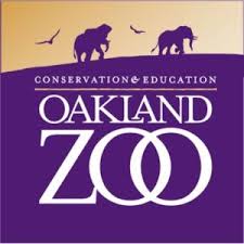 The Oakland Zoois a zoo located in the Grass Valley neighborhood of Oakland, California, United States. Established in 1922, it is managed by the Conservation Society of California, a 501(c)3 non-profit organization dedicated to the conservation of wildlife both locally and globally. The Zoo is home to over 700 native and exotic animals. It's recognized for its outstanding animal care, particularly its elephant care program, and for its Leed-certified, 17,000 square foot, state-of-the-art veterinary hospital—the largest wild animal veterinary facility in Northern California. (source: Wikipedia)
- Tilden Regional Park, also known as Tilden Park,is a 2,079-acre (841 ha) regional park in the East Bay, part of the San Francisco Bay Area in California. It is between the Berkeley Hills and San Pablo Ridge. Its main entrance is near Kensington, Berkeley, and Richmond. The park is contiguous with Wildcat Canyon Regional Park. The park is managed by the East Bay Regional Park District, created from the first land the District purchased in 1936. (source: Wikiepedia)
- The Redwood Valley Railway is a 15 in (381 mm) gauge miniature railway in Tilden Regional Park near Berkeley, California. It was established in 1952 by Erich Thomsen as the Tilden South Gate and Pacific Railway, on a 12 in (305 mm) gauge, and has since expanded to 1 1⁄4 miles (2 km) of track and carries over 160,000 passengers a year. Thomsen worked in the engineering department for the Western Pacific Railroad and received at least three patents for his work. The railway occupies land near the base of Vollmer Peak that was previously used as an anti-aircraft gun emplacement. 800 now-mature redwood trees were planted when the railroad was initially laid out. In 1968, the railroad was re-gauged to 15 in (381 mm) in. The new 15" gauge, 5" scale equipment allowed two adults to ride side by side and is representative of American narrow gauge railroads. (source: Wikipedia)
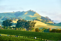
Bay Area Attractions – Wine Country
- The Sonoma TrainTown Railroad(commonly called "Sonoma Train Town") is a tourist railroad and 10 acre amusement park in Sonoma, California. Its logo is based on the logo for the New York Central Railroad. Its main feature is a 15 in (381 mm) gauge miniature railway, which closely corresponds to a 1:4 scale model of a 4 ft 8 1⁄2 in (1,435 mm) standard gauge railroad. TrainTown was founded by Stanley L. Frank of Oakland, California. In 1958 he "began bringing his dream railroad to life, building everything himself, from the houses and landscaping to the line's two steam locomotives and one electric engine." The railroad opened to the public in 1968. Frank died in 1977, and his son Robert Frank has continued to run the day to day operations of TrainTown alongside his wife Barbara and his daughter Monica. TrainTown also features a beautiful carousel, a mine train roller coaster, and an airplane ride. The petting zoo includes many animals, some of whom are rescues, such as goats, chickens, ducks, llamas, sheep, and bunnies. (source:Wikipedia and website)
- Happy Travelers Tours is the Sonoma Valley’s original educational cannabis tour and specializes in putting Guests up-close-and-personal with Cannabis plants. Working with other cannabis industry professionals, Happy Travelers Tours has created unique experiences designed to educate, inform and explore the California Cannabis lifestyle. (source: website)
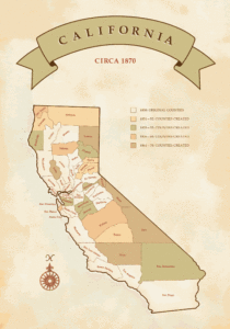
Sonoma County - an Original California County
When the State of California was created in 1850, it designated Sonoma County one of the original 27 California Counties, and the City of Sonoma was selected as the County Seat. Over time this changed and the County Seat moved to the biggest city in Sonoma County, the City of Santa Rosa.
This post will discuss some of the milestones which occurred in Sonoma County history. We'll start with this table, which is a summary of the development of the Cities which make up Sonoma County.
The Cities of Sonoma County
[table id=1 /]
Another interesting note in Sonoma County's history is it took sex seriously. Besides General Hooker's house in the City of Sonoma (which is how the word "hooker" came to mean prostitute - during the Civil War, General Hooker let the Ladies camp near his Troops and over time they became known as Hooker's Girls ... and then Hookers) the county was home to many brothels and bordellos.
Before Wine, it was Women and Song
 While The "oldest profession" was outlawed in California in 1872, it persisted and was even tolerated to a certain degree in Sonoma County.
According to the book "Hidden History": “Guerneville had its ‘cribs,’ Petaluma had its ‘Green House’ and Santa Rosa had its ‘Tenderloin,... ”
During the 1890s, Santa Rosa’s red light district was located just south of Chinatown, near Santa Rosa Creek. It encompassed the area of First Street from Main (today’s Santa Rosa Avenue) to E Street, and D Street, between First and Second streets, according to the book.
Today, the Main Post Office in downtown Santa Rosa is located near the heart of the old red light district.
At the turn-of-the-century, there were five or more known brothels in close proximity, some owned by one of Santa Rosa’s largest property holders. However, the houses of ill repute offered more than just sexual favors.
One known as the “Chicken Coop,” had grooming services. And all brothels were allowed by the city to serve liquor after buying a license for $15 per month, even though the businesses operated neither as restaurants nor saloons.
Business was especially brisk when the horse races were running at the fairground. Men, awaiting their turn with the ladies of the night, would form lines along the fences opposite the bordellos.
Property values
Men would line up along the fence, across the street and the racket, the language and the smoking really offended the neighbor. In addition, the working women and patrons also could often be seen in the windows in various stages of undress.
The Santa Rosa City Council, in May 1907, passed a resolution specifically defining the boundary of the red light district. Among other things, it required establishments to be licensed, which also included each “guest” to be inspected by a doctor and subject to vacating the premises if a contagious disease was found.
End of an Era
Eventually the bordellos closed and during the 1920s the general area for that type of business moved south to neighborhoods of Santa Rosa Avenue.
What else is there to discover? Come on out for a visit and find some adventure yourself!
Visit Sonoma County!
To learn more about Sonoma County's History consider a Tour with a Certified Tourism Ambassador!
Sonoma County's First Inhabitants
Sonoma County’s First Inhabitants
Long before Europeans "found" California, Sonoma County's first inhabitants had been living and thriving in the area for thousands of years. Having migrated millennia ago, the First People of Sonoma County were numerous and lived in harmony with each other and nature.
- For thousands of years before European explorers arrived in the 1500s, California was home to more than 300,000 Native Americans, belonging to hundreds of small groups and speaking at least 90 different languages.
- The first inhabitants of California were Paleo-Indians, a great number of who migrated to the central and northern coasts. They were nomadic bands that fished and hunted along the coastline, eventually settling into villages in our region as far back as 10,000 to 12,000 years ago.
- Four main Native American tribes made their home in what is now Sonoma County between 3,000 and 5,000 years ago. The first were the Kashaya Pomo (pronounced: kash-ya POH-moh), who settled a large area along the northern coastline near present-day Fort Ross.
- The Pomo were followed by the Coast Miwok (pronounced: MEE-wok) settling along the south coast near present-day Bodega Bay.
- The Patwin settled in the southeast near present-day Sonoma and the Wappo in the northeast near the Mayacamas Mountains.
For more information see our Blog Post Early Settlers or Book a Tour with one of our partners!

Sonoma County's Early Explorers
After Italian explorer Christopher Columbus discovered and claimed the New World for Spain in 1492, the Spanish began sending expeditions to explore, conquer and settle their new discovery.
- Vasco Núñez de Balboa: In 1513, Balboa led the first European expedition to the Pacific Ocean and claimed the Pacific Ocean and all the lands adjoining it for the Spanish Crown. The Spanish believed that a city filled with silver and gold existed somewhere in their land called New Spain.
- Hernán Cortés (also spelled Cortez): then Governor of New Spain, Cortez sent an expedition in 1539 to explore the full length of what the Spanish named the Sea of Cortés (also called the Sea of Cortez) and named the land along the southern coast Baja California.
- Juan Rodriguez Cabrillo: In 1542 Cabrillo led the first European exploration of what is now the west coast of the United States. Cabrillo sailed north from New Spain to Alta (upper) California and discovered a bay that he called San Miguel, what is now the San Diego Bay. Cabrillo’s expedition continued north, sailing past present-day San Francisco, claiming all lands along the coast of Alta California for the Spanish Empire.
- Sir Francis Drake: in 1579, knowing that Spain held claim to the territory, British captain, Sir Francis Drake, sailed his ship the Golden Hind into a bay just north of present-day San Francisco and claimed the coast and all of the land for England. While the exact location is still disputed by historians, it is believed Drake may have anchored at what is now Bodega Bay. To avoid a conflict with Spain, England never publicized its claim or attempted to establish a settlement.
- It wasn’t until the mid-1700s, when Russian and British fur traders from the north started hunting sea otter pelts as far south as San Diego, that Spain felt the need to prove their ownership of Alta California by establishing settlements.
- Don Gaspar de Portolá: In June 1769, then Governor of Baja California, Don Gaspar de Portolá, established the Presidio of San Diego. San Diego was the first permanent European settlement on the Pacific Coast and served as the base of operations and military for the Spanish through their colonization and exploration of Alta California.
- Portolá’s expedition went on to establish presidios (forts) north from San Diego to Monterey and became the first Europeans to enter San Francisco Bay when, in 1770, they accidentally sailed almost 60 miles past Monterey and had to turn around. The bay was named for Saint Francis (San Francisco) de Assisi.
- Beginning in 1769, the Spanish founded a string of 21 Missions along the coast from San Diego to north of San Francisco Bay to Christianize the Native Americans living in Alta California and to further demonstrate their ownership of the territory.
- Since the only form of transportation at the time was on foot or on horseback, most of the missions and presidios were built about 30 miles apart–equal to one long day’s walk or ride, and the mission trails became the main corridor of travel along the coast used by soldiers, missionaries, merchants and explorers. The Spanish called the trail El Camino Real (The Royal Road) and we still travel over parts of the road today. It’s believed that the priests, or Padres, sprinkled mustard seeds along the trail in order to mark it with bright yellow flowers.
To learn more about Sonoma County, read our Blog Post or Visit the area and arrange for a Tour!
Sonoma County's First Settlers
By the time the United States of America was officially formed in 1776, the East Coast had been heavily settled while the rest of our country was still controlled by various nations, mainly Spain. Sonoma County (and, in fact, Northern California) had yet to even be explored!
In 1775, a Spanish expedition led by Don Juan Francisco de la Bodega mapped and named the present-day waters of Bodega Bay and its harbor, but chose not to establish a settlement on the land.
- The next explorer to arrive was a Russian fur trader, Ivan Alexandrovich Kuskov, who sailed into Bodega Bay over 30 years later, in 1809. Kuskov had been sent to Alta California by the Russian-American Company, which had a monopoly on the fur trade in then Russia-controlled Alaska. They needed to find a new source of animal pelts and supplies for Russia’s Alaskan settlements, and he discovered an abundance of resources in the area.
- With cooperation from the Kashaya Pomo people who inhabited the area, Kuskov built Fort Ross, a settlement 20 miles north of Bodega Bay. The name Ross comes from the word for Russia (Rossiia). Fort Ross became a center of agriculture, milling, brickmaking, blacksmithing and foundry work and remained the southernmost Russian settlement in North America for nearly 30 years.
- In 1821 Mexico won its independence from Spain. Alta California then became a territory of Mexico. The Mexican government operated very differently than the Spanish monarchy. Mexico allowed trade with merchants from the United States and foreign countries for the first time, and also allowed foreigners to own land (once they became Mexican citizens and converted to Catholicism), which brought the first wave of settlers to California from across the United States.
- On July 4, 1823, Padre José Altamira founded Mission San Francisco Solano de Sonoma in the present-day City of Sonoma. It was the last and northernmost California mission and the only one established in California under independent Mexico.
- In 1833, General Mariano G. Vallejo was sent to our region by Mexico’s Governor, Jose Figueroa, to settle the area for Mexico and maintain a close watch over the Russian settlement at nearby Fort Ross. Vallejo was very important to our region’s development and is considered to be the founder of the cities of Sonoma and Petaluma.
- General Vallejo, who was then 27 years-old, received a land grant from the Mexican government, called Rancho Petaluma, consisting of about 44,000 acres stretching from present-day Sonoma to Petaluma.4 He later received another grant of Rancho Soscol which increased his holdings to more than 66,000 acres– or 100 square miles.
- Vallejo resided in Sonoma and oversaw construction of Sonoma’s eight-acre central plaza (still the largest in California) and street grid, including the 110-foot wide Broadway, which leads directly to the plaza (now called Sonoma Square or Sonoma Plaza).
- El Presidio de Sonoma (Sonoma Barracks) was constructed in 1836, to house General Vallejo’s troops.
- From 1834-1846 Vallejo also built Petaluma Adobe in Petaluma, which served as the headquarters of his large ranching operation. By 1845, Vallejo owned 10,000 head of cattle, 24,000 sheep, and several large herds of horses making him the wealthiest, and one of the most politically powerful men in California.
- Keeping it in the family, in 1834 Vallejo's brother-in-law, John B. R. Cooper was granted El Molino Rancho (molino means mill), which is present-day Forestville. Cooper constructed California's first water-powered sawmill. The mill and surrounding settlement helped the area develop and served as a barrier to Russian expansion.
- In 1837, Maria Ignacia Lopez Carrillo, Vallejo’s mother-in-law, became the only woman to ever be directly given a Mexican land grant.5 She built an adobe home on Rancho Cabeza de Santa Rosa (referring to the head of the Santa Rosa Creek). Santa Rosa was named by Father Juan Amorosa after performing a baptism in the creek on the feast day of Santa Rosa (Saint Rose) de Lima.
- In 1841 Captain Henry D. Fitch of San Diego, another of Vallejo’s brothers-in law, was granted Sotoyome Rancho (named for a Wappo tribe), which is now Healdsburg. Fitch hired Cyrus Alexander to manage the Rancho in exchange for an 8,800-acre parcel of land at the edge of the Rancho.
- When Alexander's contract ended in 1845, Mose Carson (brother of famous frontiersman Kit Carson) took over as manager and Alexander settled on his tract in what is now our famed wine growing region of Alexander Valley. Sonoma Becomes the Capital of the Republic of California
- By the 1840s, settlers were beginning to move West in large numbers, traveling on newly-established overland routes; mainly the northern California Trail that came into Sacramento and the southern Old Spanish Trail into Los Angeles. Steamships from San Francisco brought travelers and settlers to San Pablo Bay, south of Petaluma, and stagecoaches carried them overland to towns across our area.
- As a result, the immigration of new settlers into our region from the United States picked-up quickly.
- Feeling the pressure of encroaching American settlement, in 1841 the Russian- American Company sold Fort Ross and its surrounding land to Captain John Sutter (who would soon discover gold in northern California). Sutter had the outbuildings dismantled and items transported to Sutter’s Fort in Sacramento. Sutter’s manager William Benitz moved into Fort Ross in 1846, establishing a ranching enterprise which endured through a succession of owners for more than 100 years.
- The Republic of Texas broke away from Mexico in 1845 and was annexed by the United States, but Mexico still claimed ownership and refused to cede the land to the U.S. As a result, tension began to mount between the Americans in the Sonoma area and the Californios (Mexicans living in Alta California) with rumors that Mexico was planning to attack the local settlers.
- On June 14, 1846, a small group of mostly American settlers marched on the Sonoma Barracks and took General Vallejo and his men prisoner. They issued a proclamation which declared Alta California to be a Republic independent of Mexico.
- This uprising became known as the Bear Flag Revolt after a hastily designed flag depicting a grizzly bear (for strength) and a five pointed star (for the Lone Star of Texas) with the words "California Republic" was raised on a flagpole in Sonoma’s Plaza.6
- The Republic of California only lasted about three weeks! The Mexican-American War (1846-1848) had already begun nearly two month earlier in Texas. Once news about the war starting finally reached Sonoma on July 9, 1846, the Bear Flag was replaced with the American Flag.
- In January 1847, U.S. troops attacked and captured Los Angeles, forcing the surrender of hundreds of Mexican troops, and ending the Mexican resistance in California.
- The Treaty of Guadalupe Hidalgo, signed on February 2, 1848, marked the end of the Mexican-American War. The United States agreed to pay Mexico $18.25 million; Mexico formally ceded California and the future U.S. states of Arizona, Nevada, New Mexico, Texas, and Utah, as well as portions of Colorado, Kansas, Oklahoma, and Wyoming to the United States.
- When the United States took possession of California in 1848, the Americans passed a Land Act that forced landholders to validate the title to their ranchos. By this time, ranchos had passed through generations and portions had been sold or traded with very few records kept.
- Many of the grants were not validated resulting in families either losing their land or losing all of their money from long court battles with the government. Ranchos became townships, and unresolved disputed grants later became our public lands.
- Although Mariano G. Vallejo was later elected to the California Senate, he lost almost all of his real estate, which once amounted to nearly 7 million acres. His home in Sonoma was all that remained of his once immense land holdings when he died in 1890.
- The timing couldn’t have been better for the U.S. to gain possession of California. In January 1848, gold was discovered at Sutter's Mill in the Sierra Nevada foothills about 40 miles east of Sacramento, which began the California Gold Rush.8 An amazing 300,000 gold-seekers poured into Northern California over the next five years. Those that didn’t strike it rich started farms and businesses to support, and profit from the miners.
- On September 9, 1850, California became the 31st state admitted into the Union and Sacramento eventually became our capital.
- It’s hard to imagine with today’s technology, but because of its remoteness from Washington D.C., Californians didn’t get the news about becoming a state until more than a month later on October 18th, when the steamship Oregon sailed into San Francisco Bay with a banner stating "California is a State!"
Learn more by reading our Blog Post or by Booking a Tour with one of our Partners.